Yet again we shall return to the possible residence and location of the Zodiac Killer when he committed his four attacks, assuming he remained at the same address during his reign of terror. Kim Rossmo, pioneer of geographical profiling and the software Rigel, has made some excellent observations regarding the Zodiac Killer and his movements after each crime.
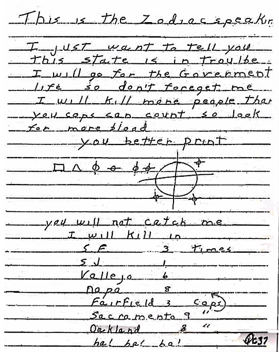
In his letters the Zodiac Killer made some telling remarks, that indicated he likely had a regular weekday profession. Not only were all his confirmed attacks on Friday and Saturday, but if we make the claim he was a resident in the Vallejo area, then he traveled further afield to San Francisco and Lake Berryessa on his rest day, when he had negligible time constraints. His first three letters to newspapers on July 31st 1969 held some vital clues. The Zodiac stated "I will go on a kill ram-Page Fry. night that will last the whole weekend.", "I will cruse around all weekend killing", and "I will cruse around killing people who are alone at night untill Sun Night." His span appears to cover Friday night to Sunday night, suggesting this was his window of opportunity and indicative of commitments during the week.
In his letters the Zodiac Killer made some telling remarks, that indicated he likely had a regular weekday profession. Not only were all his confirmed attacks on Friday and Saturday, but if we make the claim he was a resident in the Vallejo area, then he traveled further afield to San Francisco and Lake Berryessa on his rest day, when he had negligible time constraints. His first three letters to newspapers on July 31st 1969 held some vital clues. The Zodiac stated "I will go on a kill ram-Page Fry. night that will last the whole weekend.", "I will cruse around all weekend killing", and "I will cruse around killing people who are alone at night untill Sun Night." His span appears to cover Friday night to Sunday night, suggesting this was his window of opportunity and indicative of commitments during the week.

The killer mentioned the "golf course in vallejo", "good times I have had in Vallejo", "that area is surrounded by high hills + trees". In addition he targeted isolated spots frequented by courting teenagers, that suggested prior knowledge of the local area, and maybe locations that he frequently passed while traveling to work, visiting friends or engaging in pastimes. His compass or navigational markers were correct regarding both Lake Herman Road and Blue Rock Springs Park, despite the widely held belief he was incorrect during his phone call to police dispatcher Nancy Slover. Despite his distances being off slightly, simply adding a comma or pause, changes the whole meaning of the phone call. Nancy Slover attempted to talk over Zodiac to acquire details and in addition had to recall the phone conversation word for word, in context, at a later time, so we can assume it may not have been the original message verbatim.
Let us add the breaks or pauses into the passage, and other than 'one mile east', which should be 2 miles east from the payphone or police station (see here), the rest is pretty much correct. "I wish to report a double murder. If you will go one mile east...... on Columbus Parkway to a public park, you will find the kids in a brown car. They have been shot by a 9 mm Luger. I also killed those kids last year.... Good-bye." Or simply adding a comma and the word 'by', you end up with "I wish to report a double murder. If you will go one mile east, on Columbus Parkway by a public park you will find the kids in a brown car. They have been shot by a 9 mm Luger. I also killed those kids last year.... Good-bye."
To assume the Zodiac directions were wrong, would be to assume the 100% accuracy of Nancy Slover's recollection, which cannot be proved, as phone calls were not recorded during this time.
The Zodiac Killer was also correct in his description of Lake Herman Road and Betty Lou Jensen, when he wrote "the girl was on her right side feet to the west."
Another key feature was the phone call made from Springs Road and Tuolumne Street 40 minutes after the Blue Rock Springs attack, despite this payphone being only 10 minutes journey time from the crime scene. In 40 minutes the Zodiac Killer could have traveled at least 25-30 miles from Blue Rock Springs, placing the phone call in relative safety on his journey to a distant residence, but chose to remain in the area of Vallejo. This gave credence to the idea the killer traveled home, concealed his weapon, changed his clothes and returned to the payphone, greatly reducing the risk of incrimination.
 Payphone at Springs and Tuolumne
One area Kim Rossmo highlighted was American Canyon, and there are many good reasons for this. If we take the location of Eucalyptus Drive, Rio Del Mar and Cassayre Drive and calculate the journey time to these areas from Blue Rock Springs and back to the payphone, we find it takes approximately 24-34 minutes. This coupled with stashing the weapon, changing clothes and preparation for the return journey, would place us nearer to the 40 minute mark.
Eucalyptus Drive to payphone: 7 miles (12-17 minutes).
Blue Rock Springs to Eucalyptus Drive: 7 miles (12-17 minutes).
If the Zodiac Killer had taken time to plan his crimes carefully, then California State Route 29 would have taken him directly from home to Florida Street, only one mile from the payphone. Spending as little time as conceivably possible on the smaller roads and a speedy entry and exit, to and from the location of the payphone. Would the Zodiac Killer have assessed the risk factor in determining the buffer zone between his crimes and his residence, as well as the payphones and his residence. How did the buffer zones change on a Saturday, compared to Friday?
The Zodiac Killer clearly had more time to venture further afield on Saturday, but with only two attacks on this day, it is extremely difficult to compare Presidio Heights and Lake Berryessa from the standpoint of a pattern. However the route back by car from Spruce Street to Eucalyptus Drive is 46 miles and one hour. The journey time from Lake Berryessa to Eucalyptus Drive is very similar, 40 miles and just over an hour. Staying with the home location of Eucalyptus Drive in American Canyon, the Friday buffer zone would be 11 miles from Lake Herman Road and 7 miles from Blue Rock Springs. The buffer zone from each payphone after the second and third attack to Eucalyptus Drive is 7 miles and 9.5 miles respectively. But were these considerations in his planning.
The direction of the Zodiac Killer after Lake Berryessa to the 1231 Main Street, Napa payphone, is on a direct path to California State Route 29. The quickest route to San Francisco via State Route 29, is along state route 37 and Highway 101, straight to the Golden Gate Bridge into Presidio Park. Did the Zodiac Killer again plan a quick entry and exit plan after the murder of Paul Stine, creating an immediate separation within minutes of the crime. Once over the Golden Gate Bridge, he is a ghost in the night.
 Click to enter Google maps
In the 'My Name is' letter mailed on April 20th 1970, the Zodiac Killer stated "I have killed ten people to date. It would have been a lot more except that my bus bomb was a dud. I was swamped out by the rain we had a while back."
A cursory search on Google will show many examples of flooding in the region of American Canyon. It lies next to wetlands and an old landfill site, close to the eastern fringes of the Napa River.
City of American Canyon website:
"Our waters, wetlands and uplands are part of an interconnected watershed system that drains into San Francisco Bay, the largest estuary on the Pacific coasts of North and South America.
From its headwaters near Calistoga to San Pablo Bay 55 miles downstream, a drop of water falling at the top of the ridge flows by gravity into the Napa River. There are 47 tributary creeks that flow into the Napa River. Fagan Creek, Sheehy Creek, Suscol Creek, American Canyon Creek and the North Slough are in our community. The Napa River Bay Trail is located on Wetlands Edge Road and Eucalyptus Drive. Parking is provided at the Wetlands Edge Viewing Area and Trailhead. There are several trail options for an enjoyable day hiking or biking."
This area of American Canyon is noteworthy for many reasons, but as Kim Rossmo alluded: "There is no guarantee an offender will be found in the peak profile area, but all else being equal, suspects located there should be prioritized. Geographic profiling is strictly an investigative decision support tool, and a geoprofile must be considered in the context of all available investigative information."


